Showing posts with label S2. Show all posts

Tuesday, 24 May 2022

Interstices - S2, S7, S79

These are places where soon, the casual walker won't be able to visit. Fencing is going up around the roadworks; before long, the entire junction will be open, with new connections from north to south, south to north, east to south, south to east, west to south and south to west. When the junction was built, it connected only the S2 to the S79 (running into Warsaw, passing the airport); the southern end was a stump terminating in fields that is now turning into the S7 extension. And so for several years, the junction only served traffic flowing east to west, west to east, east to north, north to east, west to north and north to west. So - time for a peek into the new sliproads that will soon be roaring with traffic.

Below: this view you'll get from your rear-view mirror as you drive onto the S2 (westbound) from the S7. This tunnel under the S79 was completed in 2013, when the S79 opened for traffic, connecting to the east-west S2. But this tunnel was built to connect the S7 extension to the S2 westbound. At the time, it was believed that the S7 extension would be ready by 2020. 

Below: since September 2013, these lights have been on, day and night, for over eight and half years. Meanwhile, the local street-art community has been busy. You don't see graffiti on the walls of most tunnels (Wisłostrada, for example), because they are opened soon after completion.


Below: out in the open, the view drivers will have as they prepare to sweep to the right and merge with the S2 westbound, visible in the distance. And then on to Poznań, Berlin and - ultimately - Lisbon.


Below: not really deserving the status of 'tunnel', the link between the S7 and S2 eastbound merely dives under the bridge carrying the Warsaw-Radom railway line. Again, this sliproad has stood idle since being completed in 2013.


Below: abandoned railway infrastructure. Unlike the old signal box, some 80m to the north, this building (I guess a machine room operating the switchgear?) has survived. The signal box was demolished in 2017 during the modernisation work of the Warsaw-Radom railway, its role supplanted by a new digitally enabled control-centre just north of W-wa Okęcie station. Overhead, a KLM Cityhopper Embraer ERJ 190 on final approach, and hurrying south, a Koleje Mazowieckie train on its way to Radom.


If I go in there, I'll see goodness knows what. Let's go and look. There's always some trepidation when entering abandoned buildings; there may be ne'er-do-wells within. But consciously precluding that possibility, I enter. Uninhabited. And amazingly devoid of empty bottles and tins - the outdoor-drinking community are put off by the prospect of having to cross three railway tracks or an expressway.


Below: the same artists that daubed the tunnel?


Below: Google Earth is amazing. The 3D imagery extends well south of Warsaw Okęcie, this view is stunning. North is in the top-right corner.


Below: finally, the same junction, in full, from Open Street Maps. I've marked in red the sections photographed; the south-to-west sliproad and tunnel, the abandoned railway building and the short south-to-east sliproad.


This time last year:
Joys of Spring

This time two years ago:
Jeziorki in May

This time three years ago:

This time five years ago

Thursday, 6 January 2022

Random January photos from Warsaw

Just some random snaps to show how glitzy and rich Warsaw has become. Below: Plac Grzybowski, looking west towards Aleja Jana Pawła II. A scene unrecognisable from pre-EU accession times. The investment has poured in, as have the jobs. Quality jobs.


Below: ul. Próżna, just around the corner from my office. Once a street of ruins, a street that had survived the destruction of the Ghetto almost intact but was in a dreadful state by the late 1990s.


Below: I wrote about last month's opening of the S2 expressway tunnel under Ursynów, which now effectively allows transit traffic to pass through Warsaw without encountering any traffic lights. This new ad, just west of Węzeł Lotnisko, the S2/S79 [and future S7] junction, is for an eaterie on the other side of the tunnel (actually 8km away and 1km off the S2). A bit more info (such as opening hours) would be useful.


Below: completed and opened last year, the new Ferrari showroom on ul. Wirażowa is immediately suggestive of a wealthy population. Work started in 2018, testament to how rapidly Warsaw was rising in international rankings of wealth. Before moving here, Ferrari's Warsaw showroom was housed (somewhat symbolically) in the former building of the central committee of the Polish communist party, the PZPR.


Fossil-fuel-powered trappings of wealth are not for me - I'd rather spend the cash on domestic comforts and doing up the działka (and maybe another classic motorbike?)


This time two years ago:
The Inequality Paradox: pt.2

This time three years ago
Jakubowizna in mid-winter

This four years ago:
Warm winter's day in Jakubowizna

This time five years ago:
Seeking an aesthetic in the Grim

This time six years ago:
UK overtakes France as the World's 5th Biggest Economy 

This time eight years ago:
Ice in the Vistula

This time 12 years ago:
A consolation to my British readers

This time 13 years ago:
Winter in its finery

The time 14 years ago:
Snow fences keep the trains running

Sunday, 2 January 2022

Grabów, Krasnowola and Jeziorki Północne

Not that often that I visit the north of my little manor - Jeziorki Północne north of ulica Sporna, up and over the S2 and into Grabów. Once I used to drive the children to school this way every morning. Many years ago. What was driven is now walked. So, join me for a stroll.

Below: the bottom end of ul. Kujawiaka, where it meets ul. Jeziorki. This muddy track, maybe three metres wide, is a proper Warsaw street; the sign informs taxi drivers where Zone 2 begins, the Warsaw equivalent of  "double-time on the metre, guv." What taxi driver would like to venture down here?


Ul. Kujawiaka was once called ul. Poloneza. Since the S2 cut a line across the Jeziorki-Grabów border, the lower part of it (1.5km) south of ul. Krasnowolska, has been renamed, up to and including the viaduct that crosses the S2 and the Metro's rail link to the outside world. From the narrow muddy path, above, to a four-lane road in a few hundred metres. The northern end, north of ul. Krasnowolska, retains the Poloneza name.

Below:
S2 heading east, photo taken from ul. Kujawiaka. Note the railway line to the right of the photo - this is the Metro rail link.


Below: 400m separates a muddy path to a four-lane viaduct - the same road. Ul. Kujawiaka, looking towards its northern end, where it joins ul. Krasnowolska.


Below: Krasnowola bus loop - end of the line, by a decorated wayside chapel. This is where the 239 terminates, a weekdays-only local line linking Grabów with the metro. The bus stop is numbered 51, the '5' prefix suggests a temporary location. When the 239 was inaugurated in January 2018, WTP stated that this would be the case, with the intention of finally locating a permanent bus loop some half a kilometre further west (ul. Tramblanki). With the S2 tunnel now open and the S7 extension nearing completion, perhaps WTP will get round to finalising this route...


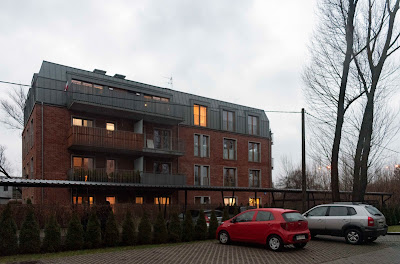
Below: repurposed brick - ul. Poloneza, south of  ul. Krasnowolska. The building (also visible in the photo above) was built during WW2 by the German occupiers to house force labour. In the late 1990s/early years of this century, it was used as a dziupla ('hidey-hole') for car thieves, who'd bring stolen cars here to be dismantled for parts. Since then, it has been converted into trendy apartments!


Below:  the 160-year old Willa Krasnowola - I wrote about this crumbling ruin nearly 14 years ago (June 2008); it's still there - neither demolished, nor repurposed - just standin' over there, decaying.

Below: looking along the unelectrified coal-train line to Okęcie sidings. To the left, the lights of the S79 expressway, set low under the flightpath to Runway 33 of Warsaw Okęcie airport. The  twin-track electrified mainline is to the left of the entirely separate single-track coal-train line.


Below: the Metro rail link, looking towards the lights of Mordor (Służewiec Przemysłowy as was, now one of Warsaw's main office districts).


Below: the Metro rail link looking towards Ursynów and the curved bridge carrying it over the S2. From here, across ul. Puławska and into the Las Kabacki forest, the line runs parallel to the expressway.


Below: ul. Hołubcowa, south of the viaduct. Another one of Warsaw's roads that runs out of asphalt and carries on to its end in the form of a muddy track meandering through fields - a track capable of swallowing cars (even 4x4s) up to their axles in thick goo.


Below: ul. Sztajerki, caught in the crook of two expressways a main railway line and international airport. Otherwise, a quiet backwater of Warsaw, around 7 miles from the city centre. Like so many streets in Zielony Ursynów ('green Ursynów') west of ul. Puławska, from Poleczki in the north to Sarabandy in the south, are named after dances. A 'sztajerek' is a folk-dance related the Ländler, being a dance in 3/4 time once popular in Austria, Bavaria, German Switzerland, and Slovenia.


Left: looking towards the top end of ul. Kujawiaka. In the foreground a small pond - the land here is poorly drained. Although there's a fair amount of traffic turning onto Kujawiaka from ul. Ludwinowska, there's little traffic continuing along Ludwinowska heading for ul. Sztajerka. Note the luminous green orb by the tree in the foreground - an internal reflection within the lens of the streetlight diagonally opposite it in the frame.


Left: ul. Kujawiaka again, this time heading back down south towards ul. Jeziorki. An airliner is on final approach to touchdown at the airport.

Miserable but warm weather (10C) and cloudy; not the stuff of flashbacks, blue skies, sparkling snow and a crisp frost. A different atmosphere altogether. Maybe flashbacks for another time, and another place.


This time four years ago:
1929-1939; 2008-2018?

This time six years ago:
Track works between W-wa Okęcie and W-wa Dawidy

This time eight years ago:
The benefits of extending the human lifespan 

This time 11 years ago:
New Year's stocktaking

This time last 12 years ago:
A walk in the wild winter woods

This time 13 years ago:
Now that's what I call winter vol. 12

This time 14 years ago:
When the day starts getting longer


Wednesday, 29 December 2021

S2 opens, unblocking east-west transit through Warsaw

I finally got round to it today - a very long (19,000 paces!) stroll from home to the western portal of the S2 tunnel, which was opened on Monday 20 December. 

Story so far - the A2 motorway/S2 expressway, which form the Polish part of European Route E30 (Cork to Omsk), got as far as Warsaw in 2012 (in time for that year's European football championships). Since then, transcontinental traffic heading east would get as far as this junction with ulica Puławska (below), and would then solidify into one huge constipated jam made up of local, regional, national and international traffic on Dolina Służewiecka. Now, over 11 years after the A2/S2 reached Warsaw, the route finally gets to cut through to the other side, via a 2.3km-long tunnel diving under the southern suburb of Ursynów. [The sign above the slip-road states that traffic over 16 tonnes is prohibited from using the S2 between 7-10am and 4-8pm. Much transit traffic will continue to use the DK50, but anyone who can will rather use the S2 - it's  27km shorter.]

For about two and half kilometres, the S2 runs parallel to a single-track railway line, the umbilical cord linking Warsaw's Metro system with the outside world. Rarely used these days (new Metro rolling stock now gets delivered by road!), the rails themselves are lightly coated with rust, suggesting the infrequent passage of a maintenance draisine. Below: looking west towards ul. Puławska, the slip-road joins the S2 to the right. The acoustic screens are effective - the roar of Puławska way behind me is louder than the traffic on the other side of the screen.


Below: looking towards the western portal of the tunnel. It dives down beneath the Metro, building the tunnel with minimal disruption to the Metro service was quite a feat of engineering! The sign says that average speed is being measured; cameras automatically capture each vehicle as it drives in and drives out of the tunnel and work out its average speed. You have been warned. 

Below: going underground. Above the tunnel, there has been much structural change to the fabric, the look-and-feel of Ursynów. I found it difficult to get my bearings along ul. Płaskowickiej, a street which I once knew intimately from morning runs to my children's primary school. 

I chose to return through the Las Kabacki forest. The Metro's rail link at this point, at twilight, takes on a very specific, eerie air. It is as if I have entered Tarkovsky's зона from Stalker by night...

Some subtle Photoshoppery going on here... That glow in the distance is from the Metro maintenance depot, but it feels like could be an atomic weapons manufacturing facility in the Urals...

On the way home I take the long way around to take a stroll over the ice on the pond on ul Pozytywki before it melts. The sign prohibits angling and littering, but there's plenty of evidence of ice-skating going on. Absolutely rock-solid ice - and you can see the high level of water in the pond this year. I like the horizon on this photo, the wires, lights and foggy sky.

Below: looking at ul. Pozytywki from the middle of the pond; a strong 1950s USA vibe. "Approaching the country club in midwinter."


I'd like to share two particularly atmospheric digital works from my brother; the one below is based on my recent photo of the new roundabout by the S7 extension viaduct - Cold fronts, Atlantic depressions and winter storms.


Below: the National Air Traffic Control radar installation, Claxby, Lincolnshire.


This time last year:
The first year of Covid-19

This time two years ago:
Last night in Ealing, twenty-teens
[A strangely prophetic post, suitably dream-like in quality]

This time three years ago:
The Day the World Didn't End
[The world's gone more shit-shaped than I dared predict]

This time six years ago:
Hybrid driving - the verdict

This time eight years ago:
Pitshanger Lane in the sun

This time 12 years ago:
Miserable, grey, wet London

This time 12 years ago:
Parrots in Ealing

This time 13 years ago:
Heathrow to Okęcie

Wednesday, 1 May 2019

Infrastructure projects coming along nicely

May Day holiday - a good opportunity to see how road and rail projects are coming on. I will focus on the Warsaw-Radom line, as this is closest to my needs. Today, I checked progress between Chynów and Michalczew via Krężel stations; work began in September, so we are eight months in. It seems the pace is fairly even, the idea being to modernise the 'up' line first, then move single-line working across from the 'down' line, then rip that up and modernise it too.

Below: a Warsaw-bound Koleje Mazowieckie train heads north up the 'down' line. Trains pass each other at Czachówek Południowy, where double-track working resumes.


Below: the 'up' track at Krężel station; half the platform has been dismantled; the trackbed is down and awaiting ballast, sleepers and rails. A new platform will be built behind where I'm standing. Once done, the remaining half of the platform will be removed and the process repeated. Island platforms such as this one are disappearing from the Radom line.


Below: level crossing near Janów, betweeen Krężel and Michalczew stations. Barriers will be installed here, as at all other level crossings on the line.


Below: new ballast is in place on this stretch of track between Krężel and Michalczew. Public holiday so no one around here.


Below: at Michalczew, work is in a similar phase to that seen at Krężel, Chynów and Sułkowice - half of an island platform for 'up' and 'down' services both using the same singe track. Note the cables coming in from the right of the pic; at Michalczew, there's an electricity substation (out of frame) that provides power for this stretch of track.


Below: the station building at Michalczew; it will remain and receive a fresh lick of paint. About 400m to the south (behind my back as it were) there were a handful of workers in bright orange overalls toiling away with an excavator, despite the public holiday.


Bonus photos from today - below: the S2 expressway (southern Warsaw bypass) on the western side of the Vistula. Much work has been completed, but there's still a vast amount to do before traffic can cross the river here.


Below: a section of the Góra Kalwaria bypass as it approaches the town. The bypass is sorely needed as Góra Kalwaria is often totally choked by traffic. Work started in mid-May 2017.


This time last year:
'Twas on a Monday morning the Electrician came to call

This time two years ago:
The Gold Train film shoot - Day Three

This time four years ago:
45 years under one roof

This time seven years ago:
May Day in the heat (it was 31C in Warsaw!) 

This time nine years ago:
Bike ride across rural Poland

This time 12 years ago:
Mazovian landmark from the air

Thursday, 3 May 2018

New roads and rails

A recent post by Student SGH prompted me to have a look at how the Warsaw's southern bypass (Południowa Obwodnica Warszawy or POW) is getting on, down by the river. The panorama (two wide-angle shots stitched together) below shows the pillars that will carry the bridge over the Vistula east of Wilanów. Work is going on quickly. One worth following on Skyscraper City. Here's the link to the latest - the 1,424th (!) page about the construction of the S2 from Puławska to Lubelska. The popularity of the thread is to do with the large number of people living around this particular project. So there are many fine photographs, many taken with drones, showing how things are progressing.


Meanwhile, there's no movement in sight along the route of the planned S7 extention from the airport to Grójec, other than the appearance of wooden stakes, painted day-glo orange on top, and waving stripy plastic tape, which are intended to show where the expressway will run.

This one (there's another in the distance, where this arable field gives way to a strip that's been left fallow) is between Dawidy (on the horizon) and Zamienie (behind and to the left of me). Somewhere here will be the first junction south of the airport, Węzeł Zamienie, the nearest to Jeziorki. Once this is completed, and the S2 with the bridge over the Vistula, the journey from home to the other side will take minutes.

Also seen (though not photographed) was the DK79 Góra Kalwaria bypass junction with the DK50, which is also progressing well. A massive roundabout, where the two main roads will meet, is taking shape.

Below: a rare shot of a weedkiller train making its way from Siekierki towards the coal train sidings at Jeziorna, seen here passing through Bielawa.


Below: worth throwing in this shot - it shows the globalisation of trade. This is the Chengdu-Rotterdam container crossing the Vistula, taken from a tram on the Most Gdański bridge. Note the emergency instructions ('in case of danger, break glass') on the window.


These container trains between China and western Europe (and back) are becoming regular sights on Polish rails; here's one, below, snapped a few days earlier at Czachówek (on the line from Duisburg to Chengdu). This is the Skierniewice-Łuków line (to the right the junction and spur running ofp to Radom.


This time last year:
The Gold Train shoot - lessons learned

This time four years ago:
Digbeth, Birmingham 5

This time five years ago:
Still months away from the opening of the S2/S79 

This time six years ago: 
Looking at progress along the S79  

This time seven years ago:
Snow on 3 May

This time eight years ago:
Two Polands

This time nine years ago:
A delightful weekend in the country

This time ten years ago:
The dismantling of the Rampa

This time 11 years ago:
Flag day