
Fields run south from ul. Katarynki to the border, marked with a long, straight drainage ditch running east-west. The rooftops on the horizon are in Mysiadło (which is not Warsaw).

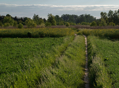
Below: looking west along ul. Katarynki. As rural a scene as one can imagine in Poland, with a cart-track running between fields; we are still actually within Warsaw's boundaries.
Below: looking east towards the last houses on ul. Katarynki. Note the proliferation of solar panels - a subject I intend to return to.

Below: drainage ditch running between ul. Katarynki (to the right) and ul. Żmijewska (to the left). Neither street has asphalt, both end up in a dead end surrounded by fields. On the horizon to the left, three large piles of builder's sand, stored by Falbruk, a road-building and repair company headquartered on ul. Karczunkowska.


Scramble up to the top of the hill for some good views. Below: looking west towards Jeziorki and the railway line, between W-wa Dawidy station to the left and W-wa Jeziorki station to the right. Beyond, on the horizon, the Las Kabacki forest. Zielony (Green) Ursynów at its greenest.


I turn 90 degrees to the left for an even more stunning than ever panorama of central Warsaw, getting better as the hill I photograph from rises ever higher. Work on the S7 is progressing at a rapid pace.
Below: the sun has set over the horizon, its afterglow still visible, reflected from the pond and from the clouds. The Sublime Aesthetic; the sensual and the spiritual, merging.

This time last year:
This time three years ago:
Warsaw wealthier than most of UK shock!
This time five years ago:
Opening of the railway line to Warsaw's Okęcie airport
Warsaw wealthier than most of UK shock!
This time five years ago:
Opening of the railway line to Warsaw's Okęcie airport


3 comments:
I do like your monochrome photo - a cheeky tribute to Ansel Adams perhaps? I do feel an opportunity emerging to mimic Moonrise, Hernandez, New Mexico using a toy horse:) Or, if it should rain, perhaps The Tetons and the Snake River:)
The great hedge of India, of which perhaps nothing remains, what a venture. But some markers of ill-favoured boundaries remain. Twenty years ago I found several traces of the ditch dug to delineate the short-lived 1941 boundary between Northern Transylvania and rump Romania.
@WHP:
The B&W photo was indeed a tribute to the American photographer Adams... although a different one! Robert Adams, whose work my brother introduced me to last week! Ansel was my mentor, his books The Camera, The Negative and The Print were my bibles as it were when I was doing evening classes at Central St Martins back in the 1980s. I will be doing more 'cheeky tributes' in coming posts (more Ansel than Robert, it must be said).
Re: Northern Transylvania and rump Romania - do have a look at this blog about borders by an Italian guy with an Estonian wife; http://pillandia.blogspot.com/search/label/Rumeenia (is the Romanian section). I'll write to him and suggest he has a look at that 1941 border - he's fascinated by ephemeral boundaries!
Thank you for tagging me, Michael Dembinski.
There are also still traces of the border between Hungary and Romania before 1920. Please see
http://pillandia.blogspot.com/2015/02/1913-hu-ro-ungari-rumeenia-ungheria.html
and magnify the first photo.
All good wishes and congrats on your awesome website!
Post a Comment