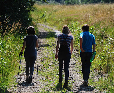
 Above: from left: Zosia, Sabina and Eddie. We've set off along the green tourist trail (zielony szlak turystyczny) that runs from the DK 28 in Dobra. All looks straightforward here.
 Left: Still easy going - the waymarks are clearly displayed, the path winds ever higher. But once we reach the top of this plateau, we're lost. Which way is Jurków? There is actually no marked trail down. One choice is a getting down to Śmigły-Rydz pass - but we don't want to go there. Too far back to Dobra. So, reluctantly, we decide to come back exactly the same way we came up (not something I like doing).
At the top, we meet a hiker looking for the caves that run under the top of the plateau. We know they're there - but they are not signed properly. I think that a handheld GPS is the only real answer to conquering Łopień.
 Above: We spend some time looking around the plateau for the vantage point. In the distance - Mogielica - which Eddie and I visited yesterday. The vantage point at the top of Łopień is there, I've been there before - it's just that this time we can't find it.
This time last year:
From the bottom to the top
This time two years ago:
Polish regulatory absurdities
This time three years ago:
The meaning of Alignment
This time four years ago:
Joy, pain, sunshine, rain


1 comment:
Michael - I will lend you my compass any time you would like to use it!
Enjoy the balance of your travel.
Bob
Post a Comment